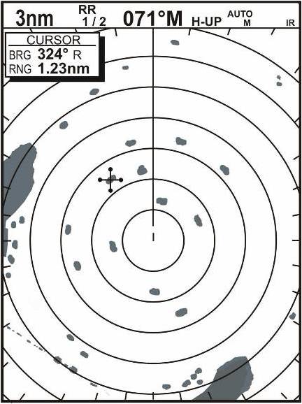
Determine your position, based on Bowdich Bay chart.
1. This is like using clues to solve a mystery. Start with what you know.
- Heading is 071° M, convert to true (056°)
- Cursor is at 324°R, convert to true
 TB = TH + RB(True Bearing = True Heading + Relative Bearing)
TB = 056 + 324 = 380. Subtract 360 to get
TB = 020°
- Land mass to your port is about 2.2 nm at closest point.
- RB to extreme point of land mass is about 309°.
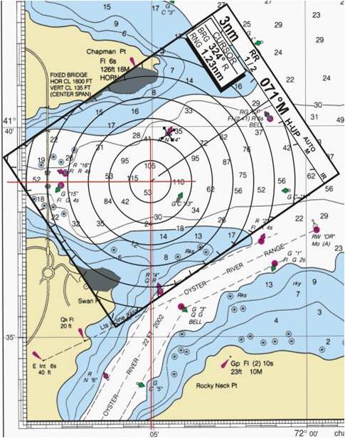
You coiuld use your circular or other protractor (if you have one), or use the course plotter - set bulls-eye at center of radar screen, and align the parellel line that goes through the bulls-eye with the edge of the island.
The "heads up" line crosses the scale on the course plotter at 309°
- Land mass to starboard is about RB 142° and about 2.3 nm.
- You could draw this pattern on tracing paper and slide it along the charts until you see a "fit", like shown below.
- If you're very observant, you might detect the bridge in the lower left hand corner of the radar display.