AP Cruise

Akron Power Squadron - Advanced Piloting Class

Day  1 - Starts on p 113
Part of the challenge of the cruise is knowing where to start.  Here is a list of the lat/lon positions of key locations in part 1 of the cruise.  Latitude is in degrees N, longitude is degrees W.   If you see any errors below, please let me know.

Quissett Harbor        L 41° 32.5'     Lo  70° 39.9'
BW "BB" Mo (A) BELL     L 41° 30.8'     Lo  70° 51.1'
"7"Fl G 4 sec BELL                  L 41° 26.9'     Lo  70° 53.4'
R "6"Fl R 4 sec BELL                      L 41° 27.9'     Lo  70° 57.0'
R "2"Fl R 2.5 sec BELL                  L 41° 26.1'     Lo  71° 00.3'
Buzzards Light  L 41° 23.8'     Lo  71° 01.7'
Gooseberry Neck  / TOWER  L 41° 29.1'     Lo  70° 02.0'
Acoaxet TANK          L 41° 30.5'     Lo  71° 05.3'
GR C buoy Elisha LedgeL 41° 26.6'     Lo  70° 09.2
Little Compton SPIRE     L 41° 30.7'     Lo  71° 10.6'
1210 TR Chart
Please read the top of page 113, which has specific instructions for this exercise, including

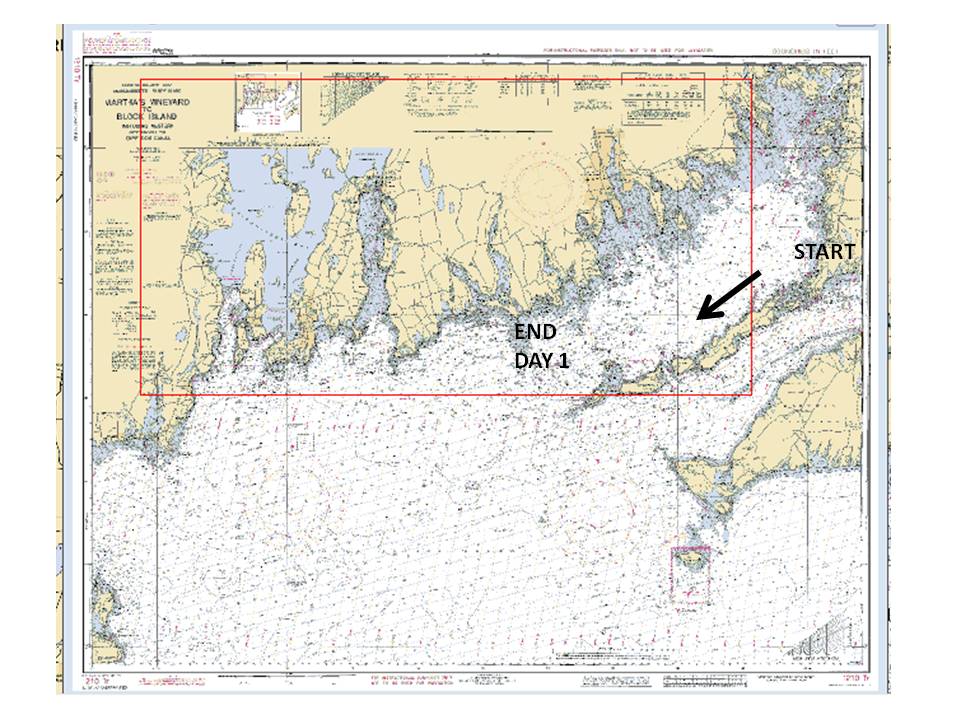
HW Questions about Cruise

1.  Info in Chart Title Block - upper LH Corner of Chart

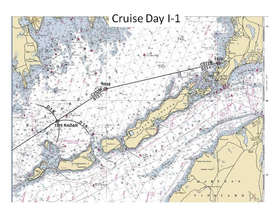
2a.    Position R "2" Fl R 4 sec   -  L 41° 32.5' N    Lo  70° 39.9'  W
2b.    RB =  270°      Dist =  0.5 nm
2c.    Course = 272M
         use deviation table, p 81
         M = 272°   
         D = 001 E
         C = 271°
2d.    Position BW "BB" Mo (A) BELL    -  L 41° 30.8' N    Lo  70° 50.1'  W
2e.    ETA  1056
3.    Compass course = 251°
4.    1115 Radar fix    -  L 41° 28.6' N    Lo  70° 54.4'  W
5a.   MB R "2" Fl R 2.5 sec   -  342°
5b.   Depth = ~ 30'
6.    1146  Fix    -  L 41° 24.8' N    Lo  71° 01.9'  W
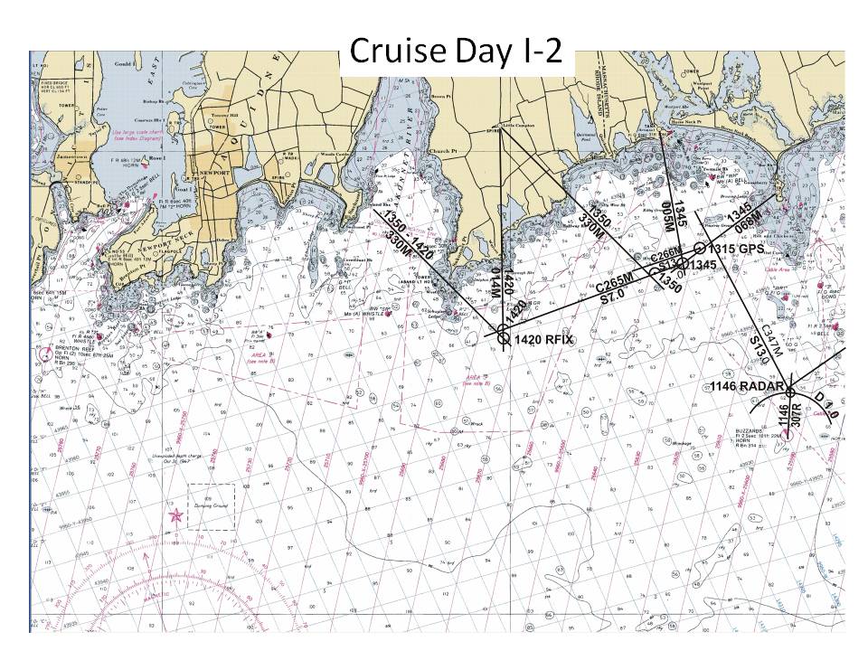
7.   Compass course  347°
8a.  Compass heading to GR C   -  265°
8b.  bottom = hard    see notation on the chart  "hrd"
9a.  Bearing to tower = . 053° true 
9b.  Bearing to tank =  350° true 
9c.   1345  Fix    -  L 41° 27.6' N    Lo  71° 05.1'  W
9d.   Compass course  264°
9e.   ETA  = 1415
10a.  1420  Fix    -  L 41° 26.0' N    Lo  71° 10.2'  W
10b.   Buoy might have broken loose , or kidnapped by aliens :)